Not Finding Your Answer?
Post It On KidzTalk Homework Help
Post It On KidzTalk Homework Help
Report a search problem

|
mobile version
Copyright 2005-2024 KidzSearch.com
|
|
 Coat of arms | |
Location of Niederbuchsiten Lua error in Module:Infobox_mapframe at line 118: attempt to index field 'wikibase' (a nil value). | |
| Coordinates: 47°18′N 7°46′E / 47.300°N 7.767°ECoordinates: 47°18′N 7°46′E / 47.300°N 7.767°E | |
| Country | Switzerland |
| Canton | Solothurn |
| District | Gäu |
| Area | |
| • Total | 5.49 km2 (2.12 sq mi) |
| Elevation | 465 m (1,526 ft) |
| Population (December 2005) | |
| • Total | 967 |
| • Density | 176.14/km2 (456.2/sq mi) |
| Time zone | UTC+01:00 (Central European Time) |
| • Summer (DST) | UTC+02:00 (Central European Summer Time) |
| Postal code(s) | 4626 |
| Surrounded by | Kestenholz, Neuendorf, Oberbuchsiten, Wolfwil |
| Website | www SFSO statistics |
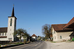
Niederbuchsiten is a municipality in the district Gäu in the canton of Solothurn in Switzerland.
view more...