|
|---|
|
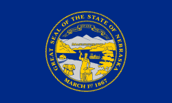
| State of Nebraska |
|
-
|
-
|
Anthem: "Beautiful Nebraska"
|
 Map of the United States with Nebraska highlighted |
| Country | United States |
|---|
| Before statehood | Nebraska Territory |
|---|
| Admitted to the Union | March 1, 1867 (37th) |
|---|
| Capital | Lincoln |
|---|
| Largest city | Omaha |
|---|
| Largest metro | Omaha–Council Bluffs |
|---|
|
| • Governor | Jim Pillen (R) |
|---|
| • Lieutenant Governor | Joe Kelly (R) |
|---|
| Legislature | Nebraska Legislature |
|---|
| U.S. senators | Deb Fischer (R)
Pete Ricketts (R) |
|---|
| U.S. House delegation | 1: Mike Flood (R)
2: Don Bacon (R)
3: Adrian Smith (R) (list) |
|---|
|
| • Total | 77,358 sq mi (200,356 km2) |
|---|
| • Land | 76,874 sq mi (199,099 km2) |
|---|
| • Water | 481 sq mi (1,247 km2) 0.7% |
|---|
| • Rank | 16th |
|---|
| Elevation | 2,600 ft (790 m) |
|---|
| Highest elevation | 5,424 ft (1,654 m) |
|---|
| Lowest elevation | 840 ft (256 m) |
|---|
|
| • Total | 1,961,504 |
|---|
| • Rank | 37th |
|---|
| • Density | 24.94/sq mi (9.63/km2) |
|---|
| • Rank | 43rd |
|---|
| • Median household income | $59,970 |
|---|
| • Income rank | 22nd |
|---|
|
| • Official language | English |
|---|
|
| most of state | UTC−06:00 (Central) |
|---|
| • Summer (DST) | UTC−05:00 (CDT) |
|---|
| Panhandle | UTC−07:00 (Mountain) |
|---|
| • Summer (DST) | UTC−06:00 (MDT) |
|---|
| USPS abbreviation | NE |
|---|
| ISO 3166 code | US-NE |
|---|
| Trad. abbreviation | Neb., Nebr. |
|---|
| Latitude | 40° N to 43° N |
|---|
| Longitude | 95° 19′ W to 104° 03′ W |
|---|
| Website | www.nebraska.gov |
|---|
Nebraska is a state near to the center of the United States. Its capital is Lincoln and the largest city is Omaha. It touches the states of Wyoming, South Dakota, Iowa, Missouri, Colorado and Kansas.
Nebraska is known for its agriculture, especially beef and corn.