

Not Finding Your Answer?
Post It On KidzTalk Homework Help
Post It On KidzTalk Homework Help
Report a search problem

|
mobile version
Copyright 2005-2024 KidzSearch.com
|
|
| Merseyside | |
|---|---|
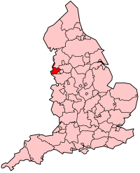 Shown within England | |
| Geography | |
| Status | Metropolitan county & Ceremonial county |
| Origin | 1974 (Local Government Act 1972) |
| Region | North West England |
| Area - Total | Ranked 43rd 645 km2 (249 sq mi) |
| ONS code | 2B |
| NUTS 2 | UKD5 |
| Demography | |
| Population - Total (2004) - Density | Ranked 9th 1,365,900 2,118/km2 (5,490/sq mi) |
| Ethnicity | 97.1% White British 2.9% Black British, British Asian, British Chinese, British Mixed |
| Politics | |
| No county council | |
| Members of Parliament | |
| Districts | |
 | |
Merseyside is a metropolitan county in North West England, with a population of 1,365,900. Taking its name from the River Mersey, the title "Merseyside" came into existence as a metropolitan county in 1974.
Merseyside is divided into two parts by the Mersey estuary: the Wirral is on the west side of the estuary upon the Wirral Peninsula; the rest of the county is on the east side. The northern part of Merseyside borders onto Lancashire to the north, Greater Manchester to the east, both parts border Cheshire to the south.
view more...