
|
 Flag  Coat of arms | |
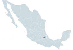 Location within Mexico | |
 Municipalities of Tlaxcala | |
| Coordinates: 19°26′N 38°10′W / 19.433°N 38.167°WCoordinates: 19°26′N 38°10′W / 19.433°N 38.167°W | |
| Country | |
| Capital | Tlaxcala |
| Municipalities | 60 |
| Government | |
| • Governor | Lorena Cuéllar Cisneros (MORENA) |
| • Federal Deputies | PAN: 2 PRD: 1 |
| • Federal Senators | Alfonso Sánchez Anaya (PRD) Minerva Hernández (PRD) Rosalía Peredo (PAN) |
| Area | |
| • Total | 4,016 km2 (1,551 sq mi) |
| Population (2005) | |
| • Total | 1,068,207 (Ranked 27th) |
| Time zone | UTC-6 (CST) |
| • Summer (DST) | UTC-5 (CDT) |
| HDI (2004) | 0.7641 - medium Ranked 24th |
| ISO 3166-2 | MX-TLA |
| Postal abbr. | Tlax. |
| Website | Official State Site |
Tlaxcala is the smallest state in Mexico with about a million people. It is in central Mexico, east of Mexico (state) and west of Puebla (state).


|