
|
 | |
 Coat of arms | |
Location of Stade Lua error in Module:Infobox_mapframe at line 118: attempt to index field 'wikibase' (a nil value). | |
| Coordinates: 53°36′3″N 9°28′35″E / 53.60083°N 9.47639°ECoordinates: 53°36′3″N 9°28′35″E / 53.60083°N 9.47639°E | |
| Country | Germany |
| State | Lower Saxony |
| District | Stade |
| Government | |
| • Mayor | Silvia Nieber (SPD) |
| Area | |
| • Total | 110.03 km2 (42.48 sq mi) |
| Elevation | 9 m (30 ft) |
| Population (2006) | |
| • Total | 56,820 |
| • Density | 516.40/km2 (1,337.48/sq mi) |
| Time zone | UTC+01:00 (CET) |
| • Summer (DST) | UTC+02:00 (CEST) |
| Postal codes | 21680, 21682–21684 |
| Vehicle registration | STD |
| Website | www |
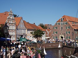
Stade is a city in Lower Saxony, Germany. It is the seat of the district which is named the same as the city.
The city was founded in 994 when it was called "Stethu". A city on the banks of the Lower Elbe it became an important market town, and a port. It was given a town charter in 1209. From 1645 to 1712, the Stade was controlled by Sweden, who made it an important military town. On May 26, 1659, the "Great Fire" destroyed more than half the city. view more...


|