
|
Orléans | ||
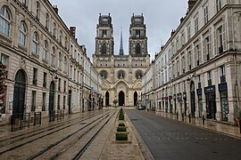 | ||
| Rue Jeanne d'Arc and the Saint-Croix Cathedral | ||
|  | |
| Administration | ||
|---|---|---|
| Country | France | |
| Region | Centre | |
| Department | Loiret | |
| Arrondissement | Orléans | |
| Canton | Orléans-1, 2, 3 and 4 and La Ferté-Saint-Aubin | |
| Intercommunality | Orléans Métropole | |
| Mayor | Olivier Carré (LR) (2015–present) | |
| Statistics | ||
| Elevation | 90–124 m (295–407 ft) (avg. 116 m/381 ft) | |
| Land area1 | 27.48 km2 (10.61 sq mi) | |
| Population2 | 114,286 (2012) | |
| - Density | 4,159/km2 (10,770/sq mi) | |
| INSEE/Postal code | 45234/ 45000 | |
| Website | www | |
| 1 French Land Register data, which excludes lakes, ponds, glaciers > 1 km² (0.386 sq mi or 247 acres) and river estuaries. | ||
| 2Population without double counting: residents of multiple communes (e.g., students and military personnel) only counted once. | ||
Orléans is a city in France, the prefecture of the Centre-Val de Loire region and the Loiret department. It is on the Loire River and was formerly a busy port. view more...


|
