
|
State of India | |
 Location of Meghalaya in India | |
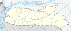 Map of Meghalaya | |
| Country | |
| Region | Northeast India |
| Area | |
| • Total | 22,429 km2 (8,660 sq mi) |
| Population (2011) | |
| • Total | 2,966,889 |
| Time zone | UTC+05:30 (IST) |
Meghalaya (Bengali: মেঘালায়া, ভারত) is a state within the Republic of India. Occupying an area of 8,660 mi² (22,429 km²), bigger than the State of Israel but smaller than Belize. Its capital is Shillong. Meghalaya's population is 2,318,822. The population of Shillong was 314,610 in 2001. There are problems in Meghalaya arise from the divide between tribals and non tribal settlers, identity issues and growing corruption besides the fear of being reduced to minority by native tribals. The activity status is classified as active. In traditional Indian geography it falls under the North-east Indian zone.
view more...

|