
|
| Irish: Laighin / Cúige Laighean | |
|---|---|
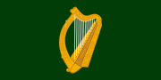 Flag  Coat of arms | |
 | |
| Coordinates: 53°20′N 6°15′W / 53.333°N 6.250°WCoordinates: 53°20′N 6°15′W / 53.333°N 6.250°W | |
| State | Ireland |
| Counties | Carlow Dublin Kildare Kilkenny Laois Longford Louth Meath Offaly Westmeath Wexford Wicklow |
| Government | |
| • Teachta Dála | 36 Fine Gael TDs 27 Labour Party TDs 8 Fianna Fáil TDs 7 Sinn Féin TDs 6 Independent TDs 4 ULA TDs |
| Area | |
| • Total | 19,800 km2 (7,644 sq mi) |
| Population (2011) | |
| • Total | 2,501,208 (1st) |
Leinster (how to say: /ˈlɛnstər/; Irish: Laighin, IPA: [lainʲ]), one of the Provinces of Ireland, lies in the east of Ireland and comprises the counties of Carlow, Dublin, Kildare, Kilkenny, Laois, Longford, Louth, Meath, Offaly, Westmeath, Wexford and Wicklow. Leinster has the largest population of the four provinces of Ireland. The traditional flag of Leinster features a golden harp on a green background. view more...


|