|
| Pashto: کابل | |||||||
|---|---|---|---|---|---|---|---|
| |||||||
| Coordinates: 34°32′N 69°10′E / 34.533°N 69.167°ECoordinates: 34°32′N 69°10′E / 34.533°N 69.167°E | |||||||
| Country | |||||||
| Province | Kabul | ||||||
| No. of districts | 22 | ||||||
| Capital formation | 1776 | ||||||
| Government | |||||||
| • Type | Municipality | ||||||
| • Mayor | Abdullah Habibzai | ||||||
| Area | |||||||
| • Total | 1,023 km2 (395 sq mi) | ||||||
| Elevation | 1,791 m (5,876 ft) | ||||||
| Population (2015) | |||||||
| • Total | 4,635,000 | ||||||
| • Density | 4,530.8/km2 (11,735/sq mi) | ||||||
| Kabul urban agglomeration | |||||||
| Time zone | UTC+4:30 (Afghanistan Standard Time) | ||||||
| Postal code | 100X, 101X, 105X, 106X | ||||||
| Climate | BSk | ||||||
| Website | km | ||||||
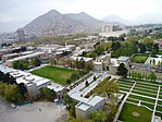
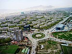
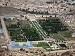
Kabul is the capital and largest city of Afghanistan.
According to a 2012 estimate, the population of the city was around 3,289,000. Ths includes Tajiks, Pashtuns, Hazaras and some other smaller ethnic groups. It is the 64th largest and the 5th fastest growing city in the world.
It is 1,800 meters, or 5,900 feet above-sea-level. Kabul is over 3,500 years old.
view more...

|