KidzSearch Image Safe Search   


Arbûmont  (Walloon)
Herbeumont — Maison communale.jpg
Flag of Herbeumont
Coat of arms of Herbeumont
Coordinates: 49°46.85′N 05°14.25′E / 49.78083°N 5.23750°E / 49.78083; 5.23750Coordinates: 49°46.85′N 05°14.25′E / 49.78083°N 5.23750°E / 49.78083; 5.23750
CountryBelgium
CommunityFrench Community
RegionWallonia
ProvinceLuxembourg
ArrondissementNeufchâteau
Government
 • MayorJean Guillaume
 • Governing party/iesREGIS
Area
 • Total58.81 km2 (22.71 sq mi)
Postal codes
6887
Website(in French and Dutch) herbeumont.be
View of the village

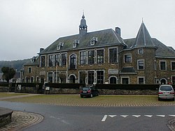
Herbeumont is a municipality in the Belgian province of Luxembourg.

In 2007, 1536 people lived there.

It is at 49° 46 North, 05° 14 East. view more...


Not Finding Your Answer?
Post It On KidzTalk Homework Help


   Report a search problem


COMPANY RESOURCES LINKS SOCIAL
contact us education daily journal home facebook
about us make us your default search kidztalk twitter  
terms/privacy blocking websites kidznet pinterest  
advertise teacher zone wiki    
media link to us learning sites    
business / api solutions add a site image search    
affiliate program kidzsearch apps kidztube    
play youtube on kidzsearch games    
  voice search music    
  report a problem cool facts    
  settings news    
    search help    


 mobile version

      Copyright 2005-2024 KidzSearch.com