
|
 | |
 Coat of arms | |
Location of Freital within Sächsische Schweiz-Osterzgebirge district | |
| Coordinates: 51°1′0″N 13°39′0″E / 51.01667°N 13.65000°ECoordinates: 51°1′0″N 13°39′0″E / 51.01667°N 13.65000°E | |
| Country | Germany |
| State | Saxony |
| District | Sächsische Schweiz-Osterzgebirge |
| Subdivisions | 15 |
| Government | |
| • Mayor | Klaus Mättig (CDU) |
| Area | |
| • Total | 40.53 km2 (15.65 sq mi) |
| Elevation | 171 m (561 ft) |
| Population (2013-03-31) | |
| • Total | 39,267 |
| • Density | 968.84/km2 (2,509.3/sq mi) |
| Time zone | UTC+01:00 (CET) |
| • Summer (DST) | UTC+02:00 (CEST) |
| Postal codes | 01705 |
| Vehicle registration | PIR, DW, FTL, SEB |
| Website | www |
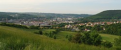
Freital is the biggest town in the Sächsische Schweiz-Osterzgebirge district, in the Free State of Saxony, Germany. It is on the small river Weißeritz, 8 kilometres (5.0 miles) southwest of Dresden. view more...


|
