
|
Kingdom of Eswatini Umbuso weSwatini (Swazi) | |
|---|---|
 | |
| Motto: | |
| Anthem: | |
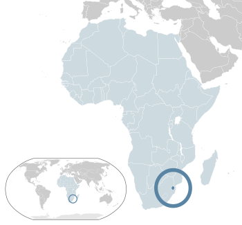 Location of Eswatini (dark blue) – in Africa (light blue) | |
 | |
| Capital | 26°30′S 31°30′E / 26.500°S 31.500°ECoordinates: 26°30′S 31°30′E / 26.500°S 31.500°E |
| Official languages | English |
| Swazi | |
| Demonym(s) | Swazi |
| Government | Unitary parliamentary absolute diarchy |
| Mswati III | |
| Russell Dlamini | |
| Legislature | Parliament |
| Senate | |
| House of Assembly | |
| Independence from the United Kingdom | |
• Granted | 6 September 1968 |
| 24 September 1968 | |
| 2005 | |
| Area | |
• Total | Lua error in Module:Convert at line 1850: attempt to index local 'en_value' (a nil value). (153rd) |
• Water (%) | 0.9 |
| Population | |
• 2016 estimate | (155th) |
• 2017 census | 1,093,238 |
• Density | Lua error in Module:Convert at line 1850: attempt to index local 'en_value' (a nil value). (135th) |
| GDP (PPP) | 2019 estimate |
• Total | $12.293 billion |
• Per capita | $11,089 |
| GDP (nominal) | 2019 estimate |
• Total | $4.662 billion |
• Per capita | $4,206 |
| Gini (2015) | ▼ 49.5 high |
| HDI (2019) | medium · 138th |
| Currency |
|
| Time zone | UTC+2 (SAST) |
| Driving side | left |
| Calling code | +268 |
| ISO 3166 code | SZ |
| Internet TLD | .sz |
Website www | |
Eswatini (or Swaziland) is a country in Africa. It is officially the Kingdom of Eswatini (Umbuso weSwatini). It was called Swaziland until April 2018.
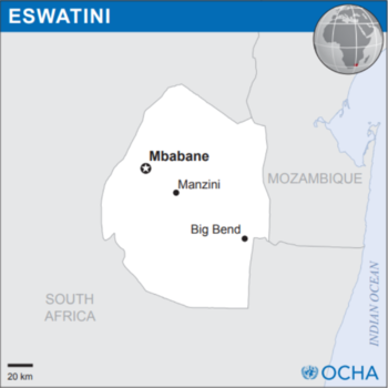
Its capital is Mbabane. The country is named after the 19th-century king Mswati II. Eswatini was colonized by the British and the Boers at the end of the 19th century.
Eswatini is a small country. It is no more than 200 kilometres (120 mi) north to south and 130 kilometres (81 mi) east to west. It is completely surrounded by land. Eswatini does not touch the sea. The two countries that touch it are Mozambique and South Africa. The country's two largest cities are the administrative capital Mbabane and the economic center Manzini. The seat of government is Lobamba.


|