
|
| Irish: Droichead Átha | |
|---|---|
Town | |
 | |
 Flag  Coat of arms | |
| Coordinates: 53°42′50″N 6°21′1″W / 53.71389°N 6.35028°WCoordinates: 53°42′50″N 6°21′1″W / 53.71389°N 6.35028°W | |
| Country | Ireland |
| Province | Leinster |
| County | County Louth |
| Dáil Éireann | Louth |
| Highest elevation | 23 m (75 ft) |
| Lowest elevation | 1 m (3 ft) |
| Population | 30,435 |
| Irish Grid Reference | O088754 |
| Website | www |
Drogheda (pronounced /ˈdrɒhədə/ or /ˈdrɔːdə/) (Droichead Átha in Irish, meaning "Bridge of the Ford") is an industrial and port town in County Louth on the east coast of Ireland, 56 km (35 mi) north of Dublin.
Within legally defined boundaries, Drogheda is the second largest town in Ireland, behind its county neighbour, Dundalk; however, the town's total population (including suburbs and environs) is recorded to be 35,090, five inhabitants more than Dundalk.

Thosel
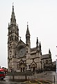
St. Peter

Magdalene Tower

St. Laurence Gate


|