
|
 Flag  Coat of arms | |
 | |
| Coordinates: 47°09′N 16°16′E / 47.15°N 16.27°ECoordinates: 47°09′N 16°16′E / 47.15°N 16.27°E | |
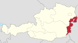
| Country | Austria |
| Capital | Eisenstadt |
| Government | |
| • Governor | Hans Peter Doskozil (SPÖ) |
| Area | |
| • Total | 3,961.80 km2 (1,529.66 sq mi) |
| Population (1 January 2016) | |
| • Total | 291,023 |
| • Density | 73.45727/km2 (190.2534/sq mi) |
| Time zone | UTC+1 (CET) |
| • Summer (DST) | UTC+2 (CEST) |
| ISO 3166 code | AT-1 |
| NUTS Region | AT1 |
| Votes in Bundesrat | 3 (of 62) |
| Website | www.burgenland.at |
The Burgenland (Austro-Bavarian: Burgnlaund, Croatian: Gradišće, Hungarian: Felsőőrvidék, Őrvidék, Lajtabánság) is one of the nine federal states of the Federal Republic of Austria. It is the youngest of the nine states and came to Austria after the First World War in 1921. The name Vierburgenland (Land of Four Castles) was created in 1919. It was derived from the name of the four vármegye of the Kingdom of Hungary (in German Komitate, 'counties') known in Hungarian as Pozsony, Moson, Sopron and Vas, or in German as Pressburg, Wieselburg, Ödenburg and Eisenburg. Because Pressburg was given to Czechoslovakia, the number was dropped. In 1922 the name was adopted by the province assembly.
view more...

|