KidzSearch Image Safe Search   


Map of Bahamas

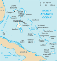
Rum Cay is an island and district of the Bahamas. Rum Cay is 20 miles (32 km) southwest of San Salvador Island. Christopher Columbus called it Santa Maria de la Concepción.

Coordinates: 23°41′N 74°52′W / 23.683°N 74.867°W / 23.683; -74.867

 
 view more...


Not Finding Your Answer?
Post It On KidzTalk Homework Help


   Report a search problem


COMPANY RESOURCES LINKS SOCIAL
contact us education daily journal home facebook
about us make us your default search kidztalk twitter  
terms/privacy blocking websites kidznet pinterest  
advertise teacher zone wiki    
media link to us learning sites    
business / api solutions add a site image search    
affiliate program kidzsearch apps kidztube    
play youtube on kidzsearch games    
  voice search music    
  report a problem cool facts    
  settings news    
    search help    


 mobile version

      Copyright 2005-2024 KidzSearch.com