
|
| Luxembourg / Lëtzebuerg / Luxemburg | |
|---|---|
 | |
 Coat of arms | |
 Map showing, in orange, Luxembourg | |
| Coordinates: 49°36′36″N 6°07′40″E / 49.61000°N 6.12778°ECoordinates: 49°36′36″N 6°07′40″E / 49.61000°N 6.12778°E | |
| Country | Luxembourg |
| District | Luxembourg |
| Canton | Luxembourg |
| Commune | Luxembourg |
| Government | |
| • Mayor | Lydie Polfer (DP) |
| Area | |
| • Total | 51.7 km2 (20.0 sq mi) |
| Highest elevation | 408 m (1,339 ft) |
| Lowest elevation | 232 m (761 ft) |
| Population | |
| • Total | 115,227 |
| • Density | 2,228.8/km2 (5,772/sq mi) |
| Time zone | UTC+1 (CET) |
| • Summer (DST) | UTC+2 (CEST) |
| LAU2 | LU00011001 |
| Website | Official website |
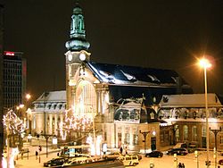
The city of Luxembourg (Luxembourgish: Lëtzebuerg, French: Luxembourg, German: Luxemburg), also known as Luxembourg City (Luxembourgish: Stad Lëtzebuerg, French: Ville de Luxembourg, German: Stadt Luxemburg), is a commune with city status, and the capital of the Grand Duchy of Luxembourg.
The city is at the confluence of the Alzette and Pétrusse rivers in southern Luxembourg. In the city is found the Luxembourg Castle, built by the Franks in the Early Middle Ages, around which a settlement developed.
view more...

|