
|
| ولاية الجزائر | |
|---|---|
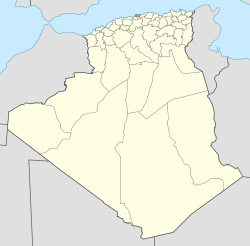 Map of Algeria highlighting Algiers | |
| Coordinates: 36°42′N 3°13′E / 36.700°N 3.217°ECoordinates: 36°42′N 3°13′E / 36.700°N 3.217°E | |
| Country | |
| Capital | Algiers |
| Government | |
| • PPA president | Mr. Mohamed Zaïm (FLN) |
| • Wāli | Mr. Mohamed Kebir Addou |
| Area | |
| • Total | 273 km2 (105 sq mi) |
| Population | |
| • Total | 2,947,461 |
| • Density | 10,797/km2 (27,960/sq mi) |
| Time zone | UTC+01 (CET) |
| ISO 3166 code | DZ-16 |
| Districts | 13 |
| Municipalities | 57 |
Algiers is a province in Algeria. It is named after the capital, Algiers, which is also the national capital. There are about 3 million people.
view more...

|